Seguimiento hidrológico de la vegetación en montaña mediterránea mediante fusión de sensores remotos en Andalucía
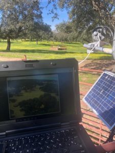
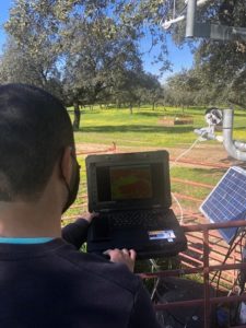
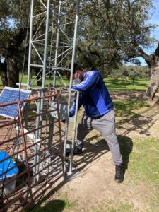
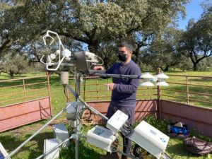
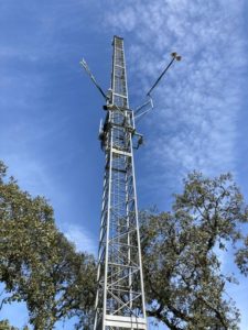
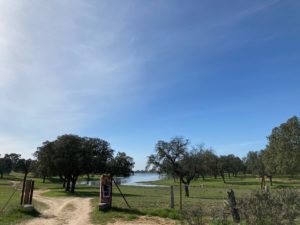
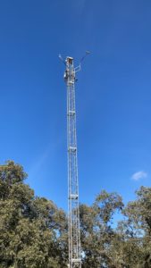
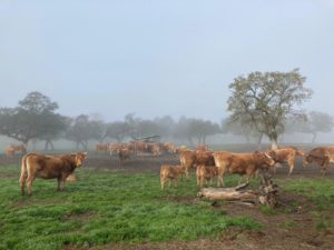
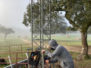
Mediterranean mountains are areas especially vulnerable to climate change effects. Future scenarios show an increasing trend in the number of heat waves and droughts, and consequently, the direct alteration of the hydrological states of their associated ecosystems. These ecosystems constitute a key element to manage with specific measures to facilitate their adaptation to these new conditions. Nevertheless, their heterogeneity, which is determined among others by the intrinsic Mediterranean climate variability and the complex topography of mountainous areas, makes the use of remote sensing techniques the best tool to monitor their distributed evolution. Limitations due to the presence of clouds and the fixed spatiotemporal resolution of these sensors require the use of additional information to obtain full and long time series of data. The use of terrestrial photography as complementary data to the traditional remote sensing information has been tested in Mediterranean mountainous areas (Pimentel et al., 2015, 2017a, 2017b). In this context this study proposes to transfer the coupled algorithm developed for ecosystems in Mediterranean mountains (snow cover evolution in Sierra Nevada) to the study of the evolution of vegetation covers in other Mediterranean ecosystem, the dehesa (Mediterranean savanna type ecosystem, with high ecological, economic and social value in the northwestern area of Andalusia. It has a very complex vegetation cover structure, where isolated trees, mainly holm oak, cork oak and oak, Mediterranean shrubs and pastures coexist), with the aim of improving the hydrological characterization of the vegetation in these areas and being able to mitigate/adapt these ecosystem to changes for i) improving the representation of the spatial distribution of the vegetation and ii) establishing a seasonal forecast system that allows the a priori diagnosis of the system and is able to take management decision. For that, the monitoring system proposed combines in situ measurements (terrestrial photography) as ground truth and the remote sensing information of the selected vegetation cover in the implementation of a data fusion algorithm, which provides high resolution data sets to feed a seasonal forecast system focused on early-detection. The project will be carried out in a dehesa representative area. It is located within a small watershed in the Cardeña-Montoro Natural Park (Córdoba), where an experimental monitoring area, coordinated by one of the research team members (Santa Clotilde), is located.
The main objective of this project is to improve the hydrological characterisation of vegetation in Mediterranean mountain areas in order to mitigate/adapt these ecosystems to changes. However, the project pursues the following specific objectives:
O1. To improve the representation of the spatial distribution of vegetation thanks to the combined use of different remote sensors, deepening their involvement in the hydrological cycle. In particular, the algorithms of spectral mixtures developed in other mountain areas will be transferred, combining information from remote sensors with terrestrial photography and new data fusion algorithms will be developed, also introducing hydrological modelling as a tool to generate continuous series of vegetation cover and its hydrological implications within the ecosystem.
O2. Establish a seasonal forecasting system to characterise the hydrological state of the system in advance and make management decisions in this respect. The forecasts provided by the European Centre for Medium-Range Weather Forecasts (ECMWF) in combination with the WiMMed hydrological model will be used to generate seasonal forecasts of meteorological and hydrological indicators that allow critical situations/states in the ecosystem to be detected, facilitating the adoption of ecosystem management measures.
The project will provide an additional database to those existing in dehesa, specifically to optimise information from remote sensors; establish eco-hydrological indicators for early warning of risk conditions for vegetation; validate an innovative, low-cost methodology that can be applied in other similar environments in Andalusia and Spain, and other areas of the world. These results will be disseminated and exploited in different areas.
Rafael Pimentel Leiva (UCO) – Responsible Researcher
María José Polo Gómez (UCO) – Researcher
María Patrocinio González Dugo (IFAPA) – Researcher
Ana Andreu Méndez (IFAPA) – Researcher
Ilias Pechlivanidis (SMHI) – Collaborator Researcher
Louise Chrochemore (SMHI) – Collaborator Researcher
Exchange with other working groups at conferences and specialised forums.
Publications in scientific journals of impact (Q1) specialised and open access journals
Scientific and transfer seminars