")
")
Determination of structural parameters of conifer species based on LIDAR data
|
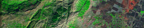
LIDAR (Light Detection And Ranging, also LADAR) is an optical remote sensing technology that can measure the distance to, or other properties of a target by illuminating the target with light, often using pulses from a laser. LIDAR is an emerging technology in the field of laser sensors, capable of generate very fast high density of georeferenced data with accuracy at least equal to that obtained by traditional methods in the field, but significantly fast. LIDAR data is acquired by combining three technologies: laser, inertial reference system of high precision (IMU, Inertial Measurement Unit) and a global positioning satellite system. The combination of these three systems, mounted on a single instrument, allows to get very fast and accurate Digital Terrain Models even under forest cover.
The lines of research conducted by Treesatlab have been focused mainly on the analysis of canopy structural variables, determining variables such us leaf area index, height, canopy cover and vertical profiles and indirect variables such us (eg., basal area, timber volume or biomass). The leaf area index (LAI) is a key variable for studies of ecophysiology of forest systems. LAI quantification is an important issue for understanding various biophysical processes and for predicting forest growth, productivity or gas exchange. LAI concept refers to all foliage of vegetation and therefore related to other variables such us photosynthesis rate, pigments content (eg., Chlorophyll), plant transpiration and CO2 exchange. The LAI had been calculated by direct methods, destructive and by indirect methods. However, these methods have limitations for estimating LAI over large areas, and canopies with complex structures. 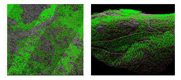
Figure 1. LIDAR data acquired from a conifer forest located in sierra de los Filabres (Almería). Details of tree identification an crown delimitation. |
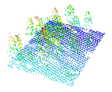
The LIDAR is able to provide information on the surface of the canopy, with high precision, which has allowed its application in various studies that require an accurate spatial evaluation of structural parameter.
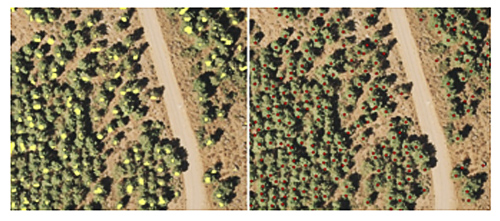
Figure 2. Details of tree identification and crown delimitation. The main work has been developed in coniferous forests (Figure 1, 2) and oak (Quercus ilex) from surface images obtained with the LIDAR sensor (ALS 50 II). Preliminary results indicate that simple methods based on sinks models followed by the definition of regular buffering show good agreement between LAI and lidar observed values of the LAI (LAIobs).
|
Navarro-Cerrillo, R. M., Sanchez de la Orden, M. S., Bonilla, J. G., García-Ferrer, A., Clemente, R. H. & Lanjeri, S. (2010). Aplicación de imágenes LIDAR para la estimación del índice de superficie foliar (LAI) en encinas [Quercus ilex L. subsp. ballota (Desf.) Samp.]. Forest Systems, 19((1)), 61-69. Navarro-Cerrillo, R. M., Hernández-Clemente R., Gómez R., García-Ferrer A., Sánchez de la Orden M (2010). Estimating LAI and height using LiDAR on pine forests on southern Spain . Operational tools in forestry using remote sensing techniques, FORESTAT, 2010. |