
The Upper Guadiato Archaeological Ager Mellariensis project headed by University of Cordoba professor Antonio Monterroso Checa has been working on the Mellaria analysis for the past two years, using the constellation of four radar satellites founded by the Italian Space Agency and Ministry of Defense. Its commecial use in Spain is managed by E-Geos-Telespazio Iberica, a Leonardo/Thales aerospace partnership company.
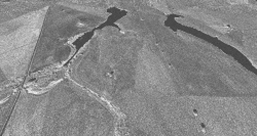
Monterroso explains that, in Spain, the Mellaria project is pioneering the application of this technology to the analysis of its territory. The results of its use were recently published in Archaeological Prospection, and have allowed for detecting invisible moist and floodable areas around the city, groundwater flow that passed through Mellaria, a possible stretch of the Roman road from Cordoba to Merida nearby, visual and topographical recovery of lost or destroyed stretches of medieval roads between the towns of Fuente Obejuna and Belmez and between the villages of La Granjuela and El Hoyo, and even the development of some crops in the area.
Few archaeology sites in the world have worked with this satellite constellation. Most of the ones that have were analyzed by the Italian-Chinese consortium, made up of the Istituto di Metodologie per l´Analisi Ambientale at Italy’s National Research Council and the Institute of Remote Sensing and Digital Earth at the Chinese Academy of Sciences. In fact, the Italian pennisula and China are, to date, the areas with the highest coverage of images and applications from an archaeological perspective. Apart from those places, the Saqqara pyramids in Egypt, the Incan site of Pachacamac in Peru and the ancient cities of Sabratha (Libya) and Hierapolis (Turkey) are other examples of the few places where patrimonial proof was found using this image system. The territory of the Roman city Mellaria can now be added to this short list of cultural heritage.
CSK missions
These radars, designed by the Italian military, carry out other civil missions apart from archaeology. In fact, the COSMO-SkyMed (CSK) network is also used to monitor Earth in order to prevent emergencies and manage environmental and humanitarian risks, such as observing human trafficking in the Mediterranean.
CSK offers the best resolution in Europe and the world for civil use, at 1m/pixel spatial resolution. In this sense, Professor Monterroso explains that “in a military aspect, this technology can detect objects even in sandstorms at a precisión of 0.40 m/pixel. That means a five-meter-long object can be analyzed pretty precisely.” This last aspect “is a huge accomplishment considering that these satellites operate from a distance of 620 km.” In addition, CSK is able to take 1,800 images a day and monitor a surface area of 400,000 square kilometers in 15 days at a spatial resolution of 3m/pixel. CSK shares data with the French optical platform Pleiades and with NASA, forming one of the most powerful consortiums of Earth observation in the world.
This study is framed in the Ager Mellariensis project, financed by the European Regional Development Fund and the National RDI Programme for Research Aimed at the Challenges of Society 2016 of the Ministry of Economy, Industry and Competitiveness.
Antonio Monterroso-Checa, A; Martínez-Reche, T.COSMO SkyMed X-Band SAR application -combined with thermal and RGB images- in the archaeological landscape of Roman Mellaria (Fuente Obejuna-Córdoba, Spain).Archaeological Prospection https://onlinelibrary.wiley.com/doi/abs/10.1002/arp.1709